There’s a land where the mountains are nameless,
And the rivers all run God knows where;
- Spell of the Yukon, by Robert Service
We took a trip to the mighty Yukon. It was a rip.
Itinerary
Finishing on August long weekend, The Guys (members of the trip, herein described as “The Guys”) underwent the following itinerary:
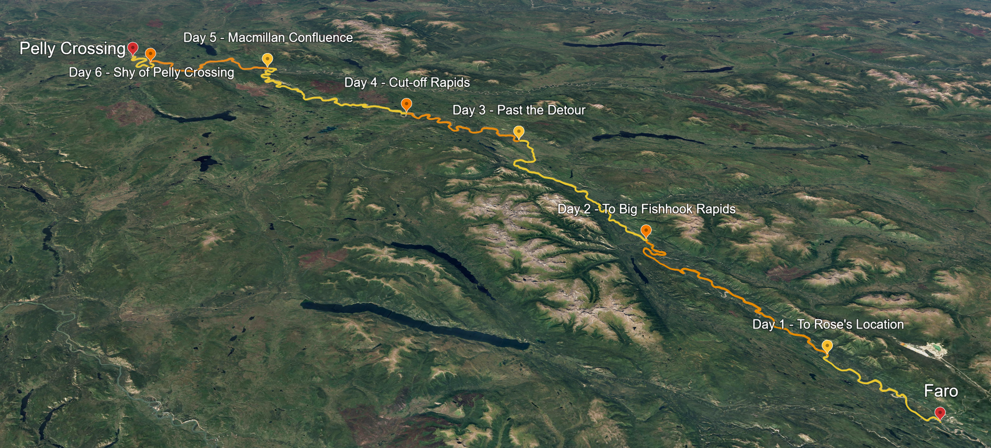
- Whitehorse to Rose’s Location (Half day, 24km)
- Rose’s Location to Big Fishhook Rapids (51km)
- Big Fishhook Rapids to Past the Detour (54km)
- Past the Detour to Before Cut-off Rapids (33km)
- Before Cut-off Rapids to McMillan Confluence (70km)
- McMillan Confluence to Needlerock Creek (25km)
- Needlerock Creek to Pelly Crossing (Half day, 35km)
- Tatshenshini River Rafting
I’ve started using Google Earth as a way to research and mark out trips - incredibly useful. This project morphed many times before the trip, and has now been updated to reflect the itinerary we took: Pelly Research - Google Earth
The River
An idea to paddle the true Great White North came abouts last year, hiking the Chilkoot trail with our local correspondant DH. I’ve greatly enjoyed my visits to the Yukon - with DH available to join us for the expedition, the brainstorming began.
While there are many excellent waters in the Yukon, we opted to save on floatplanes this year. These things considered, one river fell in our sights: the Pelly.
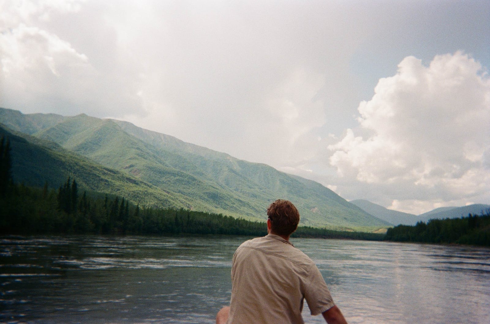
The Pelly begins in the Mackenzie Mountains, flowing at a quick pace in a westerly way before joining with the mighty Yukon River. We paddled 290km of the Pelly, past ruins of trapper cabins and hoodoos galore.
The Guide
The planning of this trip would not have been possible without the Pelly River guidebook from Rivers North Publications. A family business, their guidebook was thorough and truly indulges you in the history of the land you’re in. The stories of each location were a treat, and greatly enjoyed by all of those on the trip.
You can purchase the guidebook from Yukon Books. I hope you support these great Canadians.
Gearing Up
Setting us up with boats, paddles, lifejackets, and shuttles, we went with Up North Adventures in Whitehorse. I cannot recommend them enough! Truly an amazing outfitter.
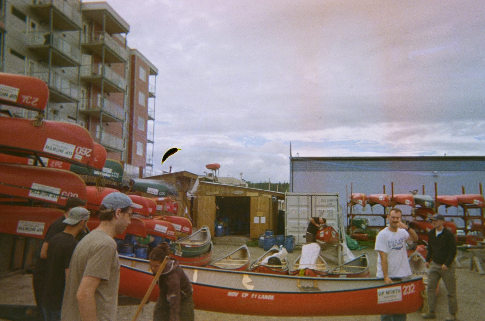
…and that was it! Turnkey service from Up North. Easy peasy.
The Trip
General Notes
- The river generally runs quick. It ranged from 4-9 km/hr, but plan on 5km/hr average. From what I can tell, this speed is generally consistent year-to-year - being a wide and shallow river, changes in the total flow rate seem to affect the width of the river more than the speed.
- The landscape is very sedimentary. You’ll see the banks eroding before your eyes, trees gradually tilting as the water cuts away at the soil beneath. You’ll notice a few points on the map where the river has cut straight through a bend. Geology in motion!
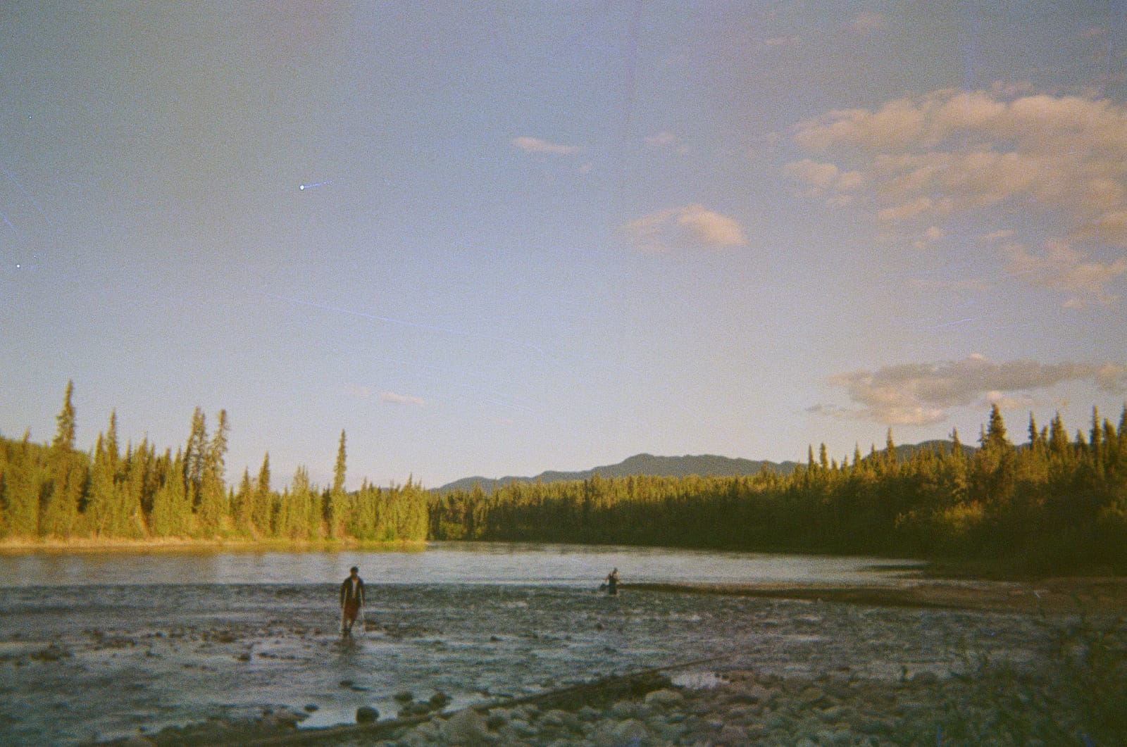
- Silty! The Pelly is a light brown colour, meaning you won’t be short on your mineral nutrition. If you so suffer for transparent agua, keep an eye for the crystal clear creeks that trickle their way in every so often.
Ah, now the trek we had.
1. Whitehorse to Rose’s Location
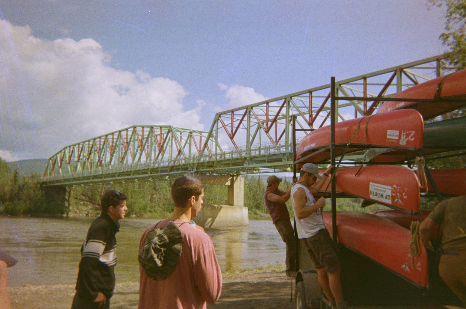
The crew hopped in our shuttle and began our journey. With stops just outside of town and again in Carmacks, folks ran into gas stations to grab the final fruits (almost literally) for the week.
We dropped at a bridge just shy of town. Yanking our gear out of the van quickly, we thanked our driver so he could begin his journey back south.
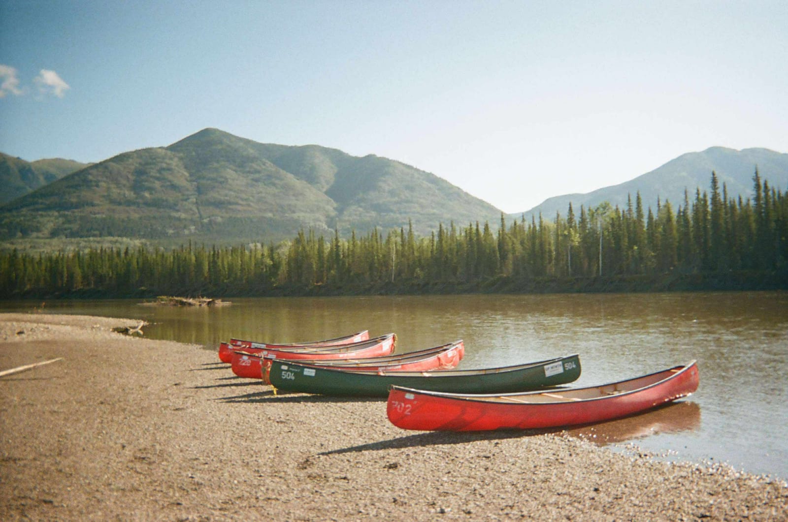
And we were off! Right away, the river moved faster than I thought. It was also cold - not as cold as the Kootenay - but certainly siltier. A light brown, a change from the icey blue of interior BC.
We made 24km in just a few hours, arriving around dinner. Like I said, the river helped a good deal.
Rose’s location is one of several storied locations in the guidebook. We camped across the river from the site of Rose’s cabin, with Rose Mountain in the backdrop.
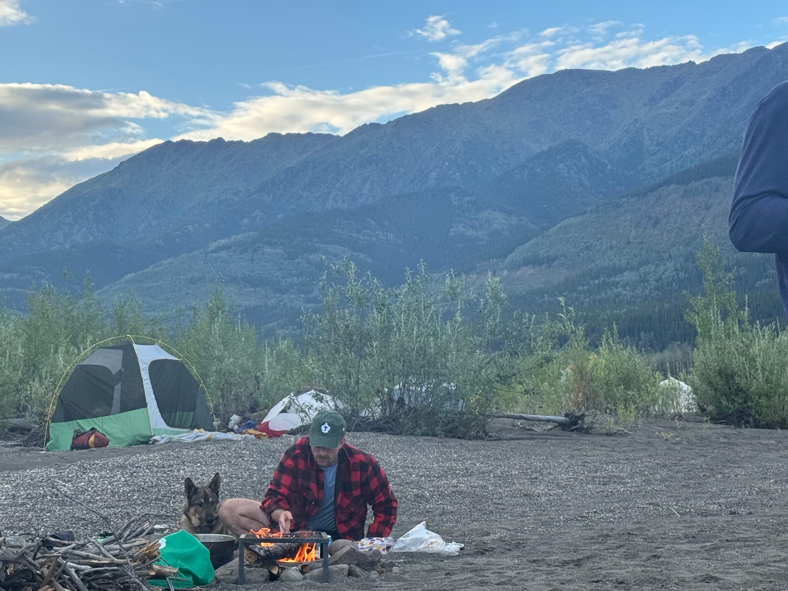
Man’s best friend, Russ, came too.
2. Rose’s Location to Big Fishhook Rapids
From Rose’s, we set out on our first real day. The river has changed from when the guidebook last recorded - we went past Little Fishhook rapids without even noticing it, while hitting an unmarked set just a few kilometers later. We stayed at Big Fishhook rapids after that, which itself wasn’t much fuss either.
The campsite sat by the Glenlyon river, a welcome source of clear water. Unfortunately, no fish were found there.
3. Big Fishhook Rapids to Past the Detour
A day spent either in a storm or outrunning it.
As we approached a stretch called The Detour, we were briefly taken off the river by thunder overhead. After spending a few minutes in the throes of it, we decided to cautiously paddle ahead, finding ourselves bone dry in just a few hudred meters. It also coincided with OLD CAMP - BUILDINGS REMAIN on our map. And they were there! While a spent can of bubly and a newspaper from 2023 stole from the sense of a historic site, it was cool to see how folks once spent time in this land.
The rest of our day was spent in the sunshine.
We stopped past The Detour on a gravel bank as the river began to bend right. This campsite was unmarked on our guide. A rocky beach, it turned to nice sand about 100m in from the water. Location was 62°43’53”N 134°43’11”W, to be precise.
4. Past the Detour to Before Cut-off Rapids
A number of The Guys - nerves wracked from a stormy day - spent the early hours of this day in indulgence. They were not in fine form by sunrise. Lucky for them, this was a short day!
Our aim was
5. Before Cut-off Rapids to McMillan Confluence
A longer day than expected. We set out the day with a campsite in mind.
6. McMillan Confluence to Needlerock Creek
More to come
7. Needlerock Creek to Pelly Crossing
More to come
8. Tatshenshini River Rafting
More to come